

Features PG Surface Pressure Charts USA
For proper flight planning, information on meteo conditions are indispensable.
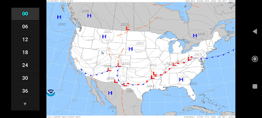
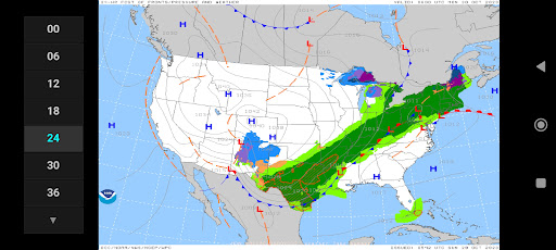
The Surface Pressure Forecast Charts App will give you a 5-day outlook on the possible developments of the large scale meteo conditions in the USA, with separate charts for Alaska.The maps have the purpose to merely supply you with large scale, longer term info.
To assess local conditions you will have to consult other, high resolution, sources.To be able to download the charts in marginal internet connectivity conditions, the charts are supplied as low-resolution images, minimizing the file size.
Higher resolution images and zooming capability would suggest a reliability of the model outputs at a smaller scale.
This has been discouraged by the meteorologists involved.The app is light, fast and very easy to use.
Use the buttons or swipe through the charts.Features:• For the USA charts: analysis and forecasts for 6, 12, 18, 24, 30, 36, 48, 60, 72, 96, 120, 144 and 168 hours• For the Alaska charts: analysis and forecasts for 24, 48, 72 and 96 hours• isobars• sea level pressure (hPa)• frontal systems (heat and cold fronts and occlusions)• weather types (rain, snow, ice, T-storm)The charts are generated and generously made available by NOAA-WPC
Social Features
Connect and share with friends and the community.
Weather Features
Get accurate weather forecasts and real-time updates.
Travel Features
Plan and manage your travels with ease.
See the PG Surface Pressure Charts USA in Action
Get the App Today
Available for Android 8.0 and above